My well-intentioned idea of using public transport to access the Aberdeenshire coastal path and to walk the path in linear sections has not really worked. Short winter days and infrequent buses mean that too much precious daylight would be spent on or waiting for a bus. So, for this bit of the path, I drove to Stonehaven then walked the sections north and south from there. I’ve written it in the reverse order to my walk so the afternoon photos come first.
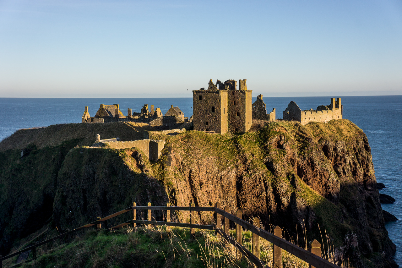
Dunnotar Castle is easily accessed from the A92. It is an impressive ruined fortress on the cliff tops with lots of historical associations. Covenanters were imprisoned there in grim conditions and a small garrison held out against Oliver Cromwell’s army for 8 months protecting the Crown Jewels of Scotland.
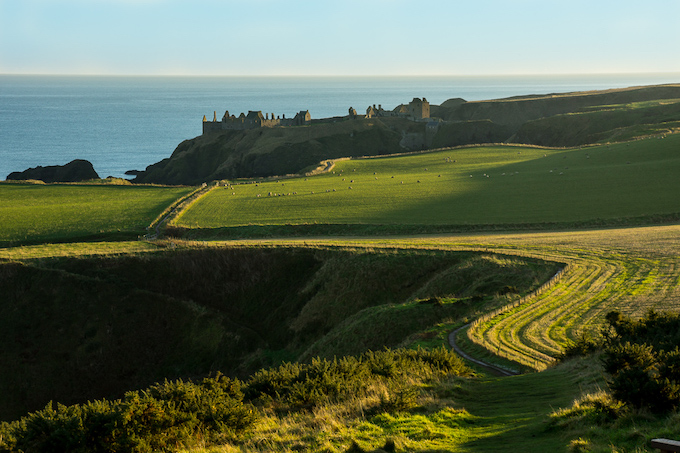
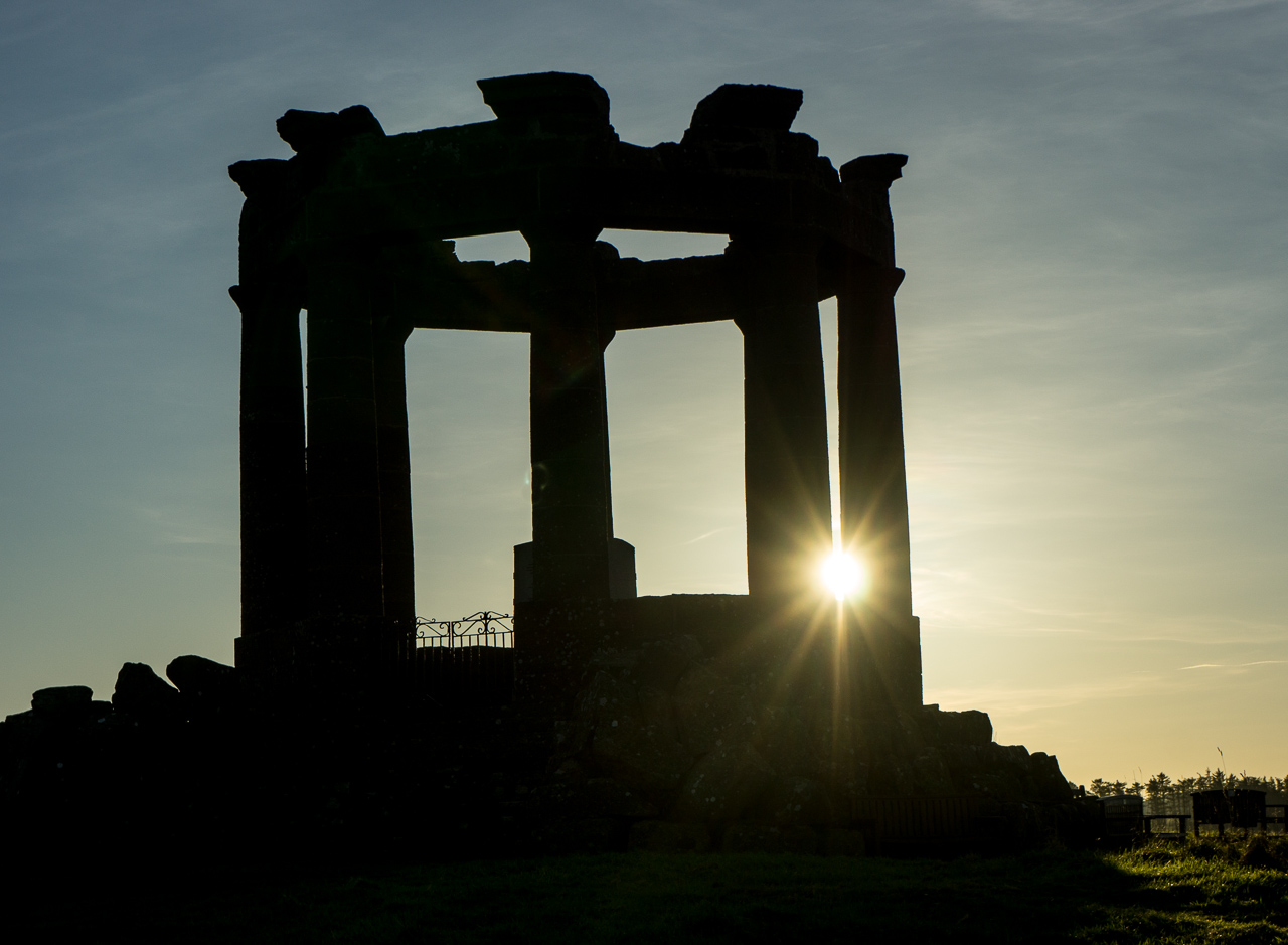
From the Castle, there’s an obvious path along the cliffs to Stonehaven where you look towards the impressive hilltop Stonehaven war memorial. There’s a great view back towards the castle from the war memorial hill.
You then have a few metres on the road before descending the Bervie Braes to Stonehaven harbour. There’s a couple of good pubs here (the Marine Hotel and the Ship Inn) with the Marine having its own brewery and a remarkable selection of different beers. Both serve good food. When I did this bit of the path in early December, Stonehaven was in shadow so I’ve used pictures here taken earlier in the year.
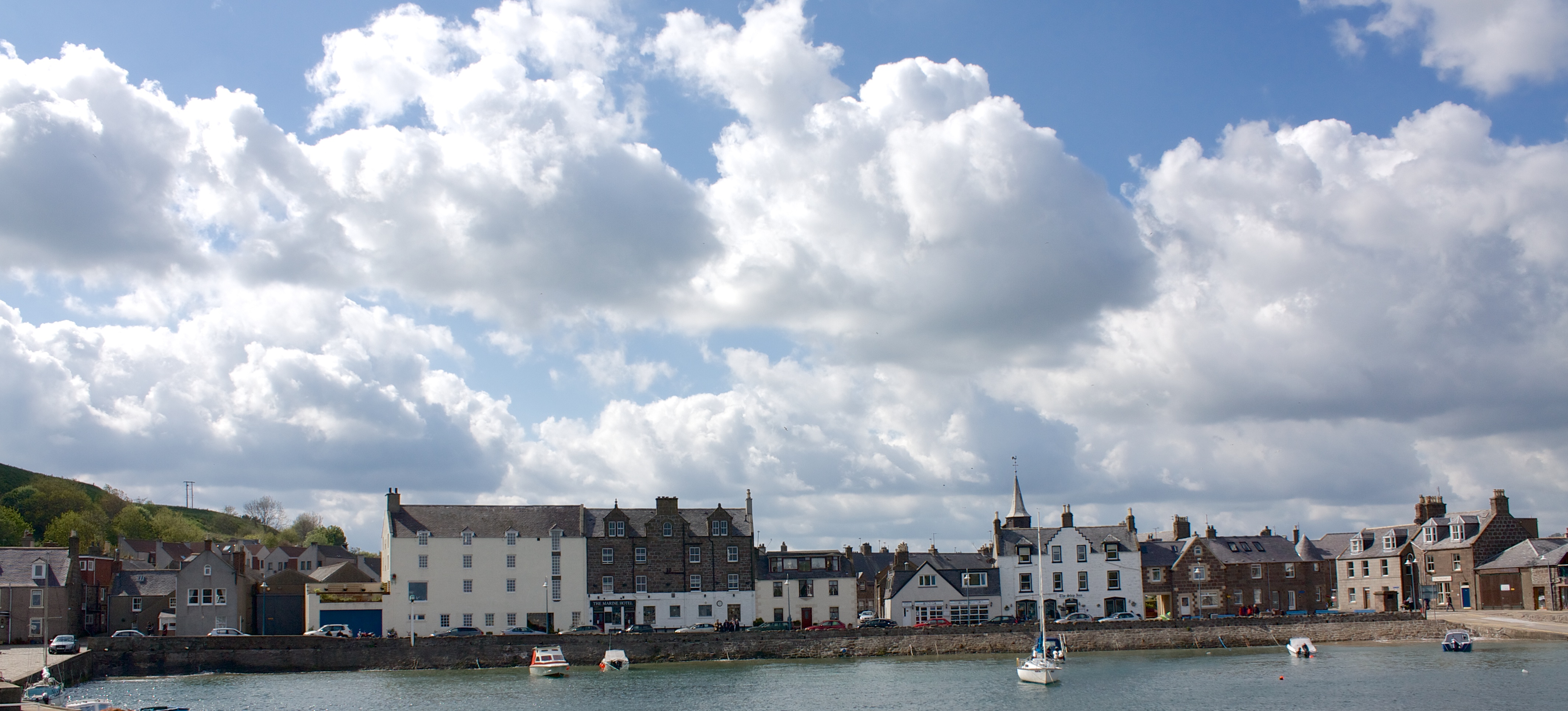
From the harbour, you cut between a couple of buildings onto the boardwalk, which runs round Stonehaven bay. You then join the promenade passing one of the few remaining outdoor swimming pools in Scotland. The Bay fish and chip shop is award%20winning with a commitment to serving sustainable fish.
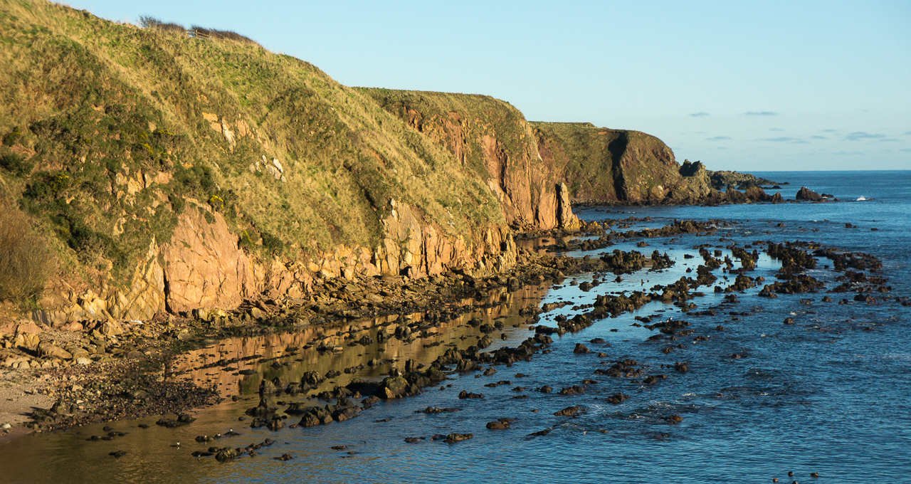
The coastal path restarts at the village of Cowie where you go along the base of the cliffs towards the Highland Boundary Fault. This is a geological fault that originates in Ireland and separates lowland and highland Scotland. The path takes you up the cliffs where I met one of the usual ridiculous health and safety notices saying the path was closed because it was dangerous. Clearly, everyone had ignored this so I did too %20 there was a tiny section that had eroded but dangerous it was not.
The path ends at the ruined chapel (reputedly 13th century) of St Mary of the Storms and the ‘official’ Aberdeenshire council route is to cut up from there to join the road and follow it to Skatie Shore. Ignore this.
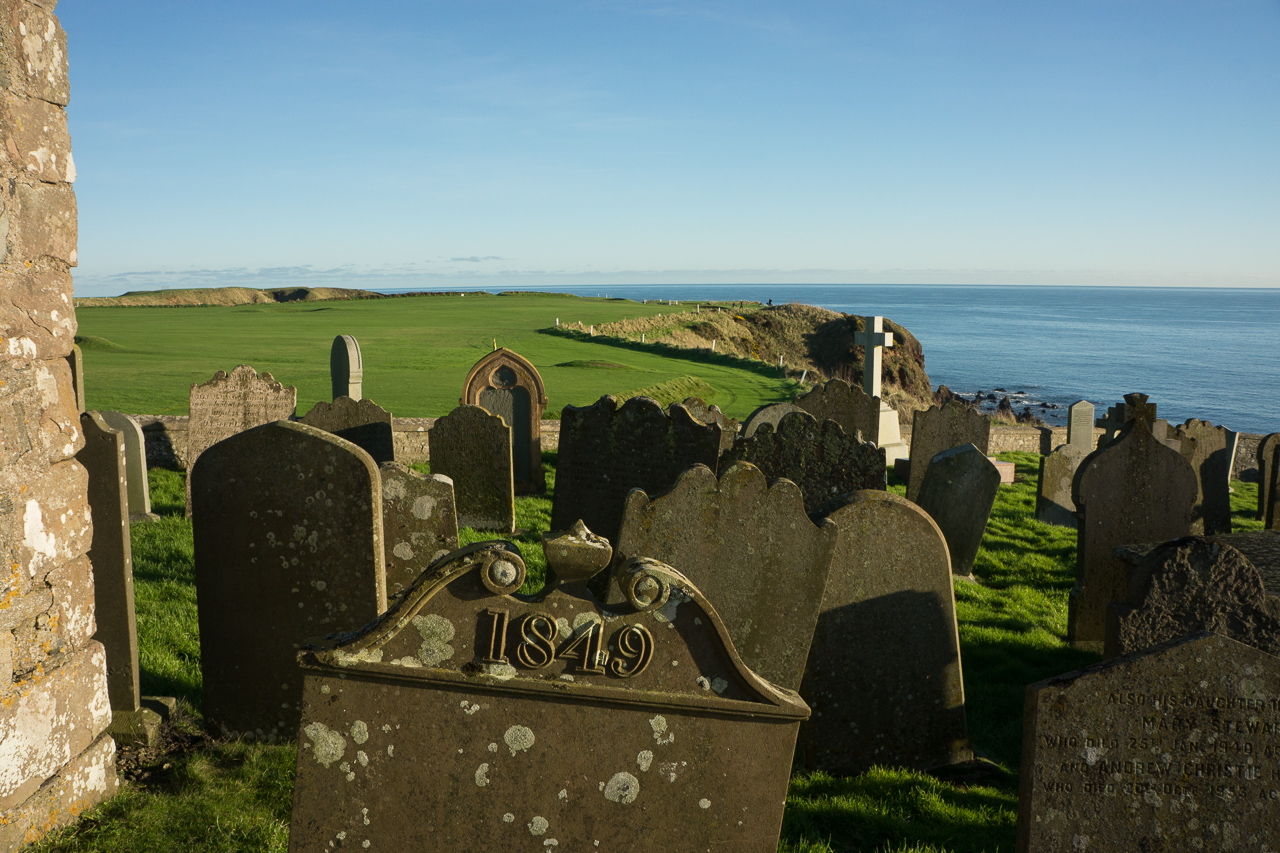
Instead, go through the churchyard where there is a gate leading onto the golf course. You then follow the edge of the course, round the cliffs (helpfully marked by white posts). So long as you keep to the perimeter of the course, there’s no problem and the golfers I met were very friendly.
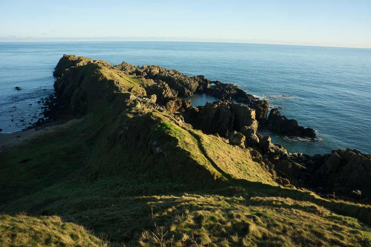
I am generally of the opinion, as summed up in the old maxim, that ‘golf is a good walk spoiled’ but if I did play, I would want to play in Stonehaven. The course has magnificent coastline views with some holes requiring a shot across an inlet. As one golfer said, when I admired his shot, “there’s a lot of balls down there”. I walked out to Garron Point and sat for a while in the winter sunshine.
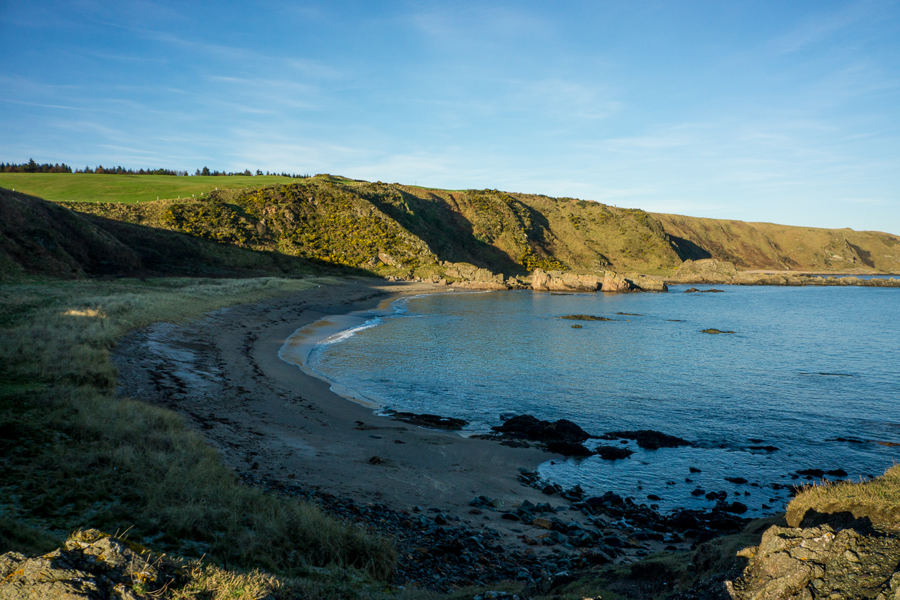
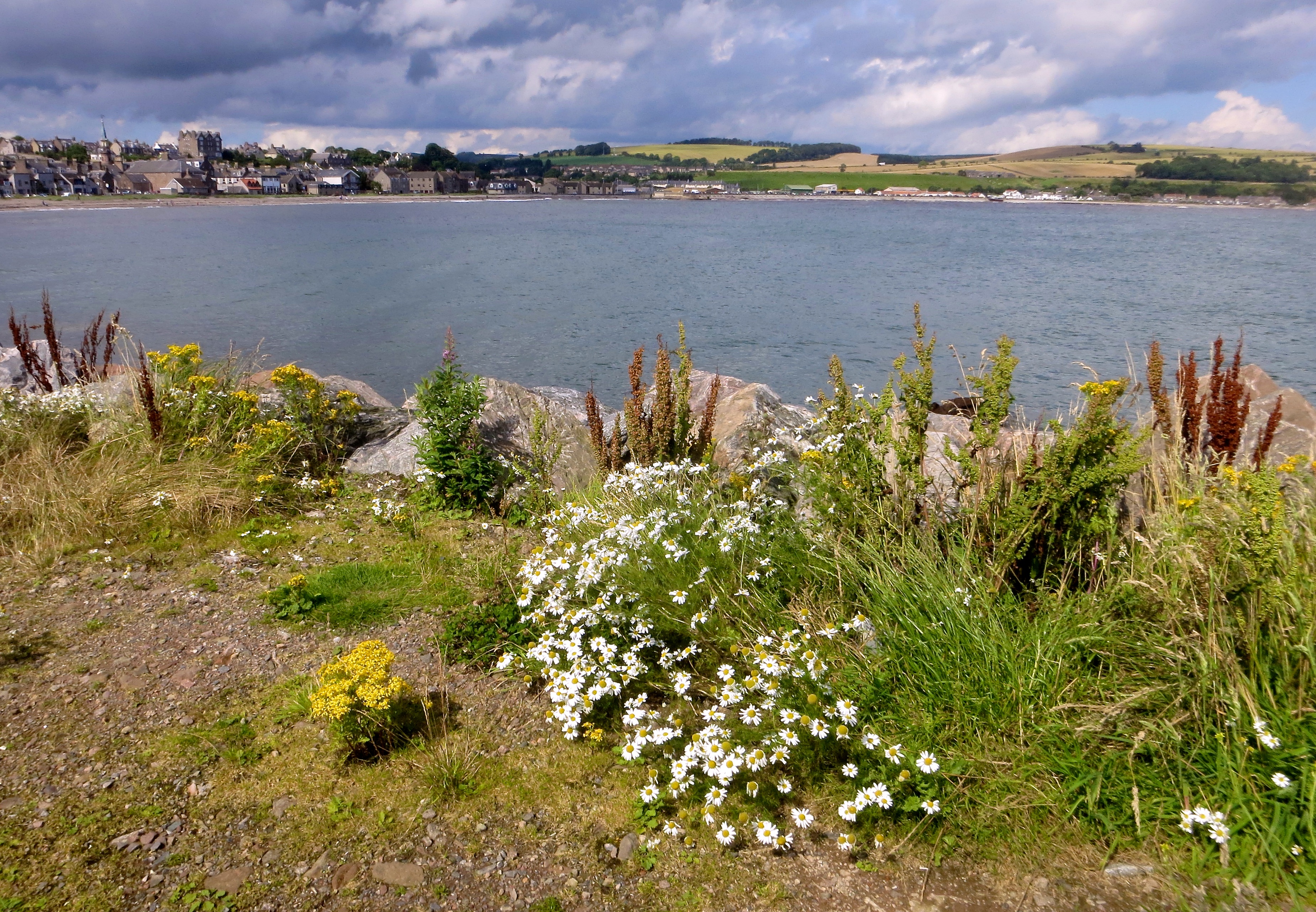
Skatie Shore is a large sandy bay where I stopped. It looks a great place for summertime picnics but it wasn’t a place to linger in the shade on a winter’s day.